My research seeks to link glacial and periglacial geomorphic change with downstream geochemical fluxes across multiple spatial and temporal scales, with the overarching goal of developing a process-based understanding of cryosphere dynamics.
Education
Ph.D., Earth and Planetary Sciences, 2021 – Present
Yale University, New Haven, CT, USA
Thesis: Investigating glacial weathering fluxes across the Mid-Pleistocene: Insights from Os isotopes
Thesis: Investigating glacial weathering fluxes across the Mid-Pleistocene: Insights from Os isotopes
Advisor: Dr. Alan Rooney
M.Sc., Geology and Geophysics, 2019 – 2021
University of Calgary, Calgary, AB, CA
Thesis: Glacier retreat and fluvial landscape response
Advisor: Dr. Dan Shugar
Advisor: Dr. Dan Shugar
B.Sc., Earth, Atmosphere, and Planetary Sciences, 2015 – 2018
Purdue University, West Lafayette, IN, USA
Gryphen Goss, M.Sc., Ph.D. Candidate
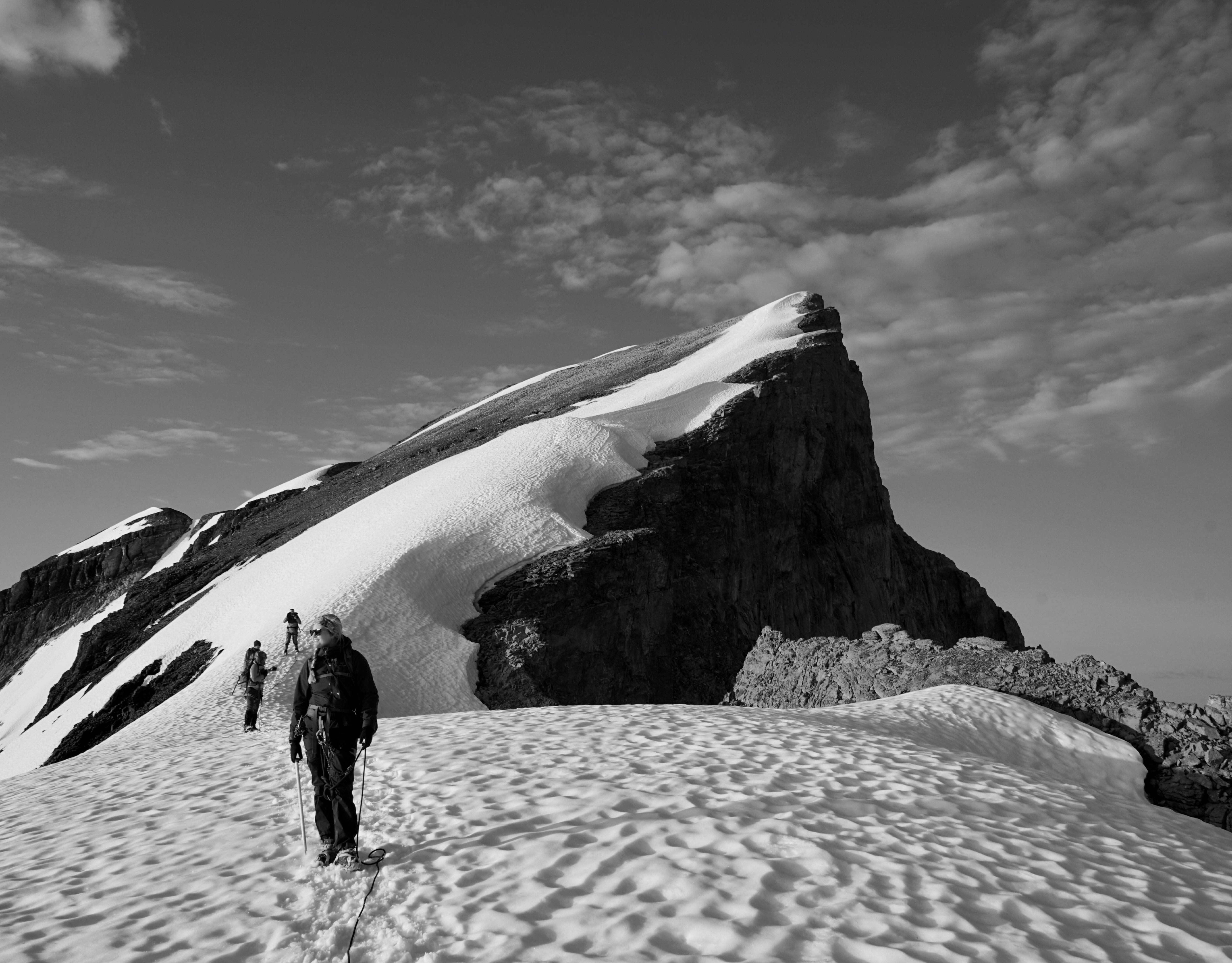
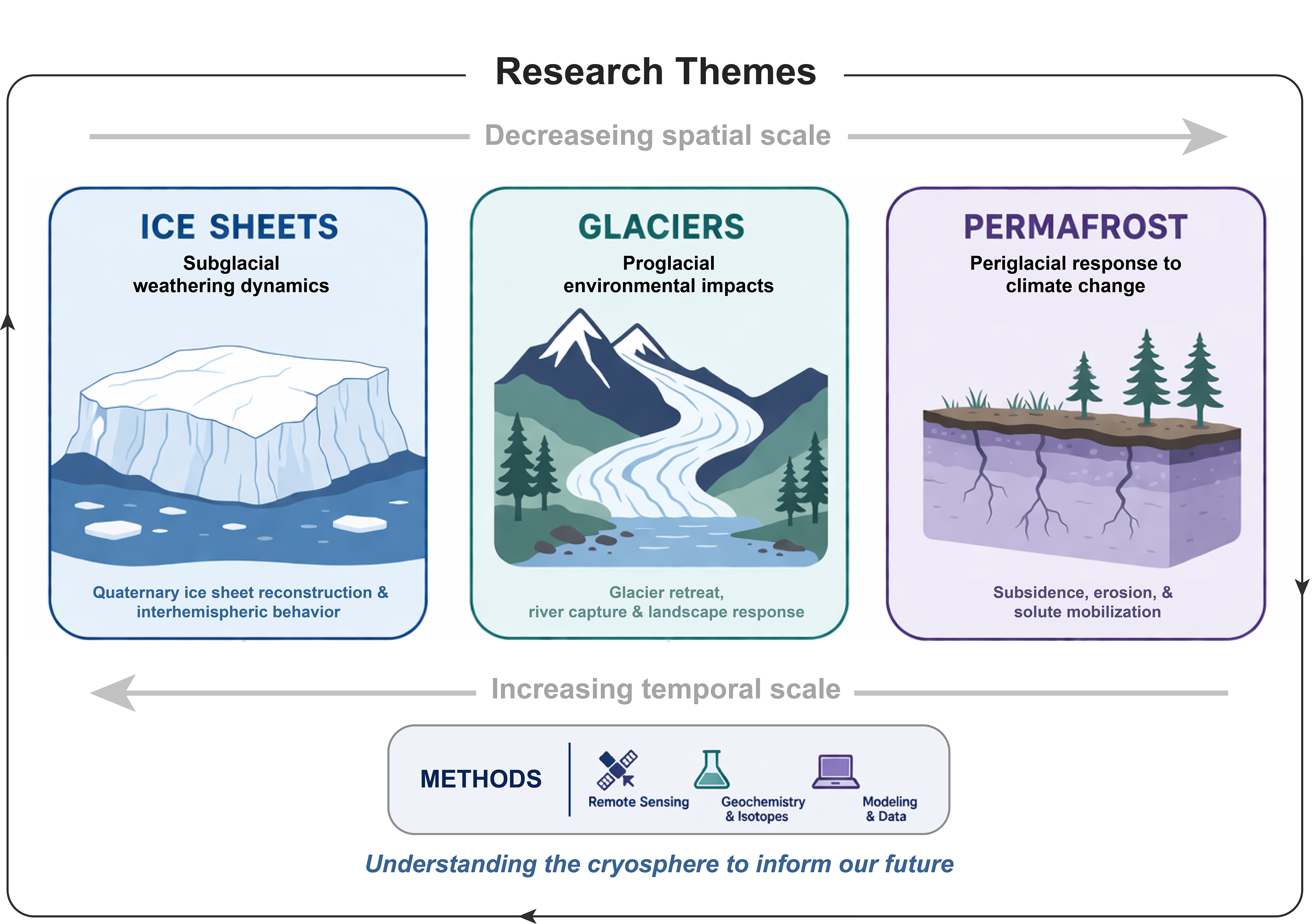
Ice Sheets - Subglacial environments
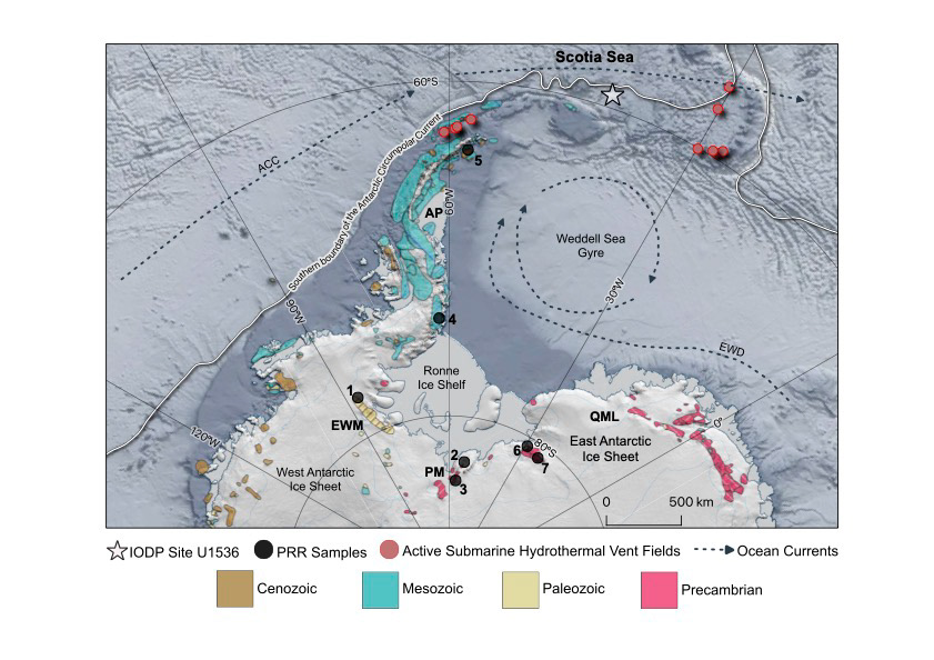
A major focus of my work is reconstructing large-scale, interhemispheric ice sheet variability across major climate transitions, such as the Mid-Pleistocene Transition (0.6–1.3 Ma). Using International Ocean Discovery Program (IODP) drill cores from the North Atlantic, Scotia Sea, and Fram Strait, I have built domestic and international collaborations that bridge geochemistry and sedimentology. This work combines osmium isotopes and stable (δ¹⁸O) isotope tools with physical sedimentary indicators (e.g., ice-rafted debris, mass accumulation rates) to provide a mechanistic understanding of past ice dynamics [Goss and Rooney, 2023; Goss et al., 2026].
Glaciers - Proglacial environments
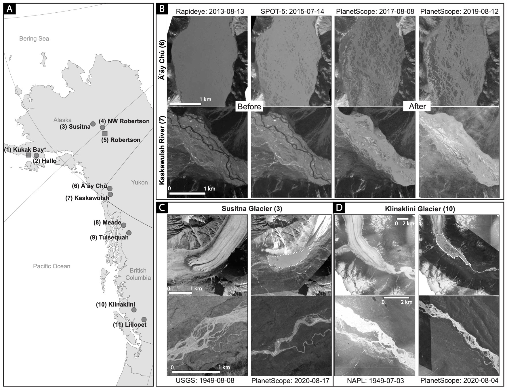
Beyond paleo-ice sheet systems, my research examines modern cryospheric change, including small-scale glacier retreat and its impacts on proglacial environments over the last ~75 years. Using optical satellite imagery and historical aerial photographs, I have quantified how glacier recession drives the formation of proglacial lakes and increases fluvial braiding complexity [Goss et al., under review]. These results highlight rapid geomorphological reorganization likely driven by shifts in discharge and sediment transport, motivating my interest in the downstream geochemical consequences of accelerating cryosphere change.
Permafrost - Periglacial environments
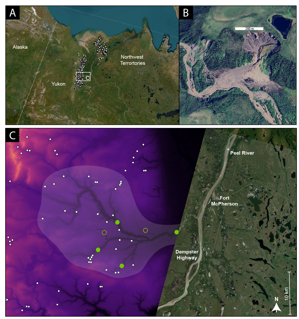
In January 2027, I will be conducting research at the University of Calgary as a postdoc fellow in collaboration with Dr. Brian Moorman in the Geography department.
I will be assessing the geomorphological and geochemical effects of permafrost thaw with a focus on the Canadian Arctic. I will integrate geochemical analyses (of sediment cores, soils, and water) with remote sensing products to quantify the magnitude, mechanisms, and consequences of permafrost degradation proximal to northern communities.